Michigan Population 2013

michigan-population-2013Michigan Population 2013

Based on estimates and the studies by the United States Census Bureau, the population of Michigan in 2013 is estimated to be 9,883,360, which is the 9th largest population in the United States. Based on the last census in 2010, this shows a very slight decrease in the population of the state of Michigan. In fact, Michigan is the only state in the country that has shown a decrease in the population in the last few years. Based on the population and based on the area of the state, the population density of the state is about 174 people per square mile, ranked the 17th largest population density in the United States. Due to the unexpected and unpredicted population decrease over the last few years, the population projections that had previously been done are no longer accurate. The population stayed steady and eventually decreased, which threw off all the expected population counts.

Michigan Land Mass

Measuring from the most distant points of the state, Michigan is 490 miles long and 240 miles wide. The state also has a square area of 96,810 square miles, making it the 11th largest state in the country. It is also the largest state east of the Mississippi River. About 40,000 square miles of the state are covered by water, compared to the approximate 56,810 square miles covered by land. Michigan is therefore the state with the second highest amount of water in the state behind Alaska. Mount Arvon is the highest point in the state, which reaches an approximate 1,979 feet above sea level. The lowest point in the state is at Lake Erie, which reaches 572 feet above sea level. The geographic center of Michigan is located in Wexford County, 5 miles north northwest of Cadillac. Three states border the state of Michigan: Wisconsin, Indiana, and Ohio. However, what makes Michigan interesting and unique is that it is also bordered by four Great Lakes: Lake Superior, Lake Michigan, Lake Huron, and Luke Erie. The only Great Lake that does not border the state is Lake Ontario.

Michigan is in fact a state made up of two separate peninsulas, called the Upper Peninsula and the Lower Peninsula. The Upper Peninsula is made up of the Superior Lowland and the Great Lakes Plain. The Superior Lowland is in the western portion of the state and is made up of rugged terrain and mountains regions. The highest point in the state is located in the Superior Upland. The Great Lakes Plain makes up the eastern portion of the Upper Peninsula and all of the Lower Peninsula. This area is quite level with many swampy regions. The lowest point in the state is also located in this part of the state.

Michigan Demographics

Approximately 50.9% of the state’s 9.883 million people is female, while the other 49.1% of the population is male. Also, approximately 80% of the population identifies as white (including Hispanic or Latino). But, out of that 80%, about 4% do identify as Hispanic or Latino and the other 76% as Caucasian. Those that identify as Black or African American make up 14% of the entire population of the state of Michigan. The rest of the population is made up of those that identify as Asian, American Indian, Alaskan Native, or those that identify as two or more races. These other races make up about 6% of the Michigan population.

Michigan Religion

The population of Michigan identifies as religious at a rate only slightly lower than the national average. About 42% of the state population identifies as religious, compared to the national average of 49%. Out of the 42%, about 18% identify as members of the Catholic Church, making it the largest denomination in the state of Michigan. All the other Christian denominations make up about 22% of the population. Those who identify as Jewish, Islamic, or Eastern religions only make up 2% of the population. There is an Islamic population of 1.2%, compared to the national average of 0.8%.

Fall Colors in Michigan
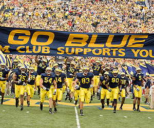
michigan-population-2013-sportsMichigan Sports

The state of Michigan has teams represented in four of the major professional sports: baseball, basketball, football, and hockey. All four of the state’s teams are based out of Detroit. The team represented in Major League Baseball is the Detroit Tigers. The Tigers play in Comerica Park. The team represented in the National Basketball Association is the Detroit Pistons. The Pistons play in the Palace of Auburn Hills in Auburn Hills, Michigan. The Detroit Lions represent the state in the National Football League. The Lions play on Ford Field. Lastly, the Detroit Red Wings represent the state in the National Hockey League. The Red Wings play in the Joe Louis Arena.

Michigan Economy

The state of Michigan has two of the top ten publicly owned companies in the country. General Motors and Ford are both located in the state of Michigan. General Motors is ranked number six and Ford is ranked number. Michigan has consistently been a large employer of high tech job opportunities. The state has also been a leader in job creation improvement over the last few years. The unemployment rate of the state is 8.4%. As of July 22, 2013, though, the city of Detroit has filed for bankruptcy, owing close to $20 billion in debt.

Michigan Nationalities

The top four nationalities in the state of Michigan are German, Irish, English, and Polish. About 22% of the population identifies as German; about 12% of the population identifies as Irish; about 10% of the population identifies as English; and, about 9% of the population identifies as Polish.

Other Resources

Learn more about Michigan here.

North Carolina Population 2013

north-carolina-population-2013North Carolina Population 2013

The United States Census Bureau estimates that the population of North Carolina in 2013 was 9,752,073, which is ranked the 10th largest population in the United States. Based on the last census in 2010, this shows a 2.3% increase in the population of the state of North Carolina. Based on the population and based on the area of the state, the population density of the state is about 212 people per square mile, ranked the 15th largest population density in the United States.

North Carolina Population Projections

Based on the historical trends of the state and expected migration, birth, and death rates, the population is expected to reach approximately 10.088 million people by the year 2015, which is an approximate 3.4% increase from the current population. By the year 2020, the population is expected to reach 10.629 million people, which is an approximate 9% increase from the current population. By the year 2025, the population is expected to reach 11.171 million people, which is an approximate 14.6% increase from the current population. By the year 2030, the population is expected to reach 11.712 million people, which is an approximate 20% increase from the current population. Lastly, by the year 2033, the population is expected to reach 12.036 million people, which is an approximate 23.4% increase from the current population.

North Carolina Land Mass

The state of North Carolina is about 500 miles long and 150 miles wide. The state also has a square area of 53,821 square miles, making it the 28th largest state in the country. About 5,100 square miles of the state are covered by water, compared to the approximate 49,710 square miles covered by land. Mount Mitchell is the highest point in the state, which reaches an approximate 6,680 feet above sea level. The lowest point in the state is at the Atlantic Ocean, which reaches sea level. The geographic center of North Carolina is located in Chatham County, 10 miles northwest of Sanford. Four states border the state of North Carolina: South Carolina, Tennessee, Virginia, and Georgia. Also, the Atlantic Ocean borders the state on the east.

North Carolina does not have distinct geographic land areas, but does have different types of terrain and land throughout the state. The eastern 40% of the state is mainly made up of coastal plains and tidewater. The next 40% of the states to the west of that area is made up of plateaus similar to the Piedmont region. The last 20% of the state is made up of rolling hills and parts of the Appalachian Mountains. The Blue Ridge and the Smokey Mountains are also part of this portion of the state.

North Carolina Demographics

Approximately 51.3% of the state’s 9.752 million people is female, while the other 48.7% of the population is male. Also, approximately 72% of the population identifies as white (including Hispanic or Latino). But, out of that 72%, about 9% do identify as Hispanic or Latino and the other 63% as Caucasian. Those that identify as Black or African American make up 22% of the entire population of the state of North Carolina. The rest of the population is made up of those that identify as Asian, American Indian, Alaskan Native, Hawaiian, other Pacific Islanders, or those that identify as two or more races. These other races make up about 6% of the North Carolina population.

North Carolina Religion

The population of North Carolina identifies as religious at a rate only slightly lower than the national average. About 48% of the state population identifies as religious, compared to the national average of 49%. Out of the 48%, about 19% identify as members of the Baptist Church, making it the largest denomination in the state of North Carolina. The next largest denomination in the state is the Methodist Church, which makes up about 9% of the population. All the other Christian denominations make up about 19.3% of the population. Those who identify as Jewish, Islamic, or Eastern religions only make up 0.7% of the population.

Enjoy a Deeper Journey in North Carolina

north-carolina-population-2013-sportsNorth Carolina Sports

The state of North Carolina has teams represented in three of the major professional sports: basketball, football, and hockey. The team represented in the National Basketball Association is the Charlotte Bobcats. The Bobcats are based out of Charlotte, North Carolina and play in the Time Warner Cable Arena. The Carolina Panthers are the team represented in the National Football League. The Carolina Panthers are based out of Charlotte, North Carolina and play the home games in the Bank of America Stadium. Lastly, the Carolina Hurricanes is the team represented in the National Hockey League. The Hurricanes are based out of Raleigh, North Carolina and play in the PNC Arena. The state also has over 18 colleges and universities that compete in NCAA Division I sports. Some of these colleges include Duke University, North Carolina State, and the University of North Carolina at Chapel Hill.

north-carolina-population-2013-parksNorth Carolina State and National Parks

The state of North Carolina has 10 national parks. The number of people that visited the 10 national parks in the year 2012 is about 17.71 million people. As a result of all of these visitors, approximately $725 million was contributed to the economy of the state due to the national parks. Along with these national parks, the state has 2 national heritage areas, 13 national natural landmarks, and 38 national historic landmarks.

North Carolina has 39 state parks, 7 state lakes, 4 state rivers, and 4 state trails. About 14.3 million people visited these state parks and state locations in the year 2011. Approximately $400 million was contributed to the economy of the state due to the state parks.

Get educated about the state of North Carolina with this link.

New Jersey Population 2013

new-jersey-population-2013-sealNew Jersey Population 2013

The United States Census Bureau estimates that the population of New Jersey in 2013 was 8,864,590, which is ranked the 11th largest population in the United States. Based on the last census in 2010, this shows a 0.8% increase in the population of the state of New Jersey. Based on the population and based on the area of the state, the population density of the state is about 1189 people per square mile, ranked the largest population density in the United States.

New Jersey Population Projections

Based on the historical trends of the state and expected migration, birth, and death rates, the population is expected to reach approximately 8.998 million people by the year 2015, which is an approximate 1.5% increase from the current population. By the year 2020, the population is expected to reach 9.244 million people, which is an approximate 4.3% increase from the current population. By the year 2025, the population is expected to reach 9.538 million people, which is an approximate 7.6% increase from the current population. By the year 2030, the population is expected to reach 9.88 million people, which is an approximate 11.4% increase from the current population.

New Jersey Land Mass

The state of New Jersey is about 150 miles long and 70 miles wide with a square area of 8,722 square miles, making it the 47th largest state in the country. Of the 8,722 square miles, 1,303 square miles are covered by water. The highest point in the state of New Jersey is High Point, reaching 1,803 feet above sea level. The lowest point in the state is at the Atlantic Ocean, which reaches sea level. The geographic center of New Jersey is located in Mercer County, 5 miles southeast of Trenton. New Jersey is bordered by two states: New York and Pennsylvania. The Delaware Bay borders the state on the south and the west. The Atlantic Ocean borders the state on the south and the east.

New Jersey is broken up into four distinct geographic land areas: the Atlantic Coastal Plain, the Piedmont, the New England Upland, and the Appalachian Ridge and Valley Region. The Atlantic Coastal Plain is the largest land area in the state of New Jersey. This is a very diverse area, ranging from fertile soil to lagoons and meadows to salt marshes. To the northeast of the Atlantic Coastal Plain is the Piedmont, making up about 20% of the state. This area is filled with rivers, making it perfect for the many industrial cities in the state. To the west of the Piedmont lies the New England Upland. This area is made up of flat-topped rock ridges with beautiful lakes around them. Lastly, the Appalachian Ridge and Valley Region lies in the northwest corner of the state. This area is the mountainous portion of the state and includes the Kittatinny Mountains.

New Jersey Demographics

Of the approximate 8.865 million people in the state of New Jersey, about 51.2% of the population is female, while 48.8% is male. Also, approximately 74% of the population identifies as white (including Hispanic or Latino). But, out of that 74%, about 19% do identify as Hispanic or Latino and the other 55% as Caucasian. Those that identify as Black or African American make up 15% of the entire population of the state of New Jersey. The rest of the population is made up of those that identify as Asian, American Indian, Alaskan Native, Hawaiian, other Pacific Islanders, or those that identify as two or more races. These other races make up about 11% of the New Jersey population. The Asian population makes up 9% out of that 11%.

Get Back to Happy in New Jersey

new-jersey-population-2013New Jersey Religion

The population of New Jersey identifies as religious at a rate slightly higher than the national average. About 55% of the state population identifies as religious, compared to the national average of 49%. Out of the 55%, about 38% identify as members of the Catholic Church, making it the largest denomination in the state of New JerseyAll the other Christian denominations make up about 11.9% of the population. Those who identify as Jewish, Islamic, or Eastern religions only make up 5.1% of the population. About 2.5% of the population identifies as members of Judaism, compared to the national average of 0.7%. About 1.8% of the population identifies as members of Islam, compared to the national average of 0.8%.

Other Resources

Check out the link to learn more about the population and demographics of New Jersey.

Washington State Population 2013

washington-state-population-2013Washington State Population 2013

The United States Census Bureau estimates that the population of Washington in 2013 was 6,897,012, which is ranked the 13th largest population in the United States. Based on the last census in 2010, this shows a 2.6% increase in the population of the state of Washington. Based on the population and based on the area of the state, the population density of the state is 103 people per square mile, ranked the 25th largest density in the United States.

Washington Population Projections

Based on the historical trends of the state and expected migration, birth, and death rates, the population is expected to reach approximately 7.03 million people by the year 2015, which is an approximate 1.9% increase from the current population. By the year 2020, the population is expected to reach 7.41 million people, which is an approximate 7.4% increase from the current population. By the year 2025, the population is expected to reach 7.80 million people, which is an approximate 13.1% increase from the current population. By the year 2030, the population is expected to reach 8.165 million people, which is an approximate 18.4% increase from the current population. By the year 2035, the population is expected to reach 8.496 million people, which is an approximate 23.2% increase from the current population. By the year 2040, the population is expected to reach 8.804 million people, which is an approximate 27.6% increase from the current population.

Washington Land Mass

The state of Washington is about 360 miles and 240 miles wide with a square area of 71,303 square miles, making it the 18th largest state in the country. Of the 71,303 square miles, 4,721 square miles are covered by water. The highest point in the state of Washington is Mount Rainier, reaching 14,410 feet above sea level. The lowest point in the state is at the Pacific Ocean, which reaches sea level. The geographic center of Washington is located in Chelan County, 10 miles west southwest of Wenatchee. Washington is bordered by two states: Oregon and Idaho. However, Canada borders the state on the north and the Pacific Ocean borders the state on the west.

Washington is broken up into six distinct geographic land areas: Olympic Mountains, the Coast Range, the Puget Sound Lowlands, the Cascade Mountains, the Columbia Plateau, and the Rocky Mountains. The Olympic Mountains take up the northwest corner of the state. The majority of this area is wild land, which mainly lies in the Olympic National Park. The Coast Range is to the south of the Olympic Mountains. The Willapa Hills are part of this area and they look over into the Willapa Bay. The Puget Sound Lowlands are to the east of the Olympic Mountains. This is the area where about 75% of the population lives. The Cascade Mountains are to the east of the Puget Sound Lowlands. This area is full of mountains, including Mt. Rainier, which is the highest point in the state. The Columbia Plateau is located in the southern and central portions of the state. This area is part of the largest lava plateau in the world. It also contains multiple types of terrains, such as canyons, hills, good, fertile soil for farming, and valleys. Part of the northeast corner of the state is made up of the Rocky Mountains. This area is filled with the Columbia Mountains and also with important minerals, such as gold and zinc.

Washington Demographics

Of the approximate 6.897 million people in the state of Washington, about 50.1% of the population is female, while 49.9% is male. Also, approximately 82% of the population identifies as white (including Hispanic or Latino). But, out of that 82%, about 11% do identify as Hispanic or Latino and the other 71% as Caucasian. Those that identify as Black or African American make up only 4% of the entire population of the state of Washington. Those that identify as Asian make up about 8% of the population. The rest of the population is made up of those that identify as American Indian, Alaskan Native, Hawaiian, other Pacific Islanders, or those that identify as two or more races. These other races make up about 6% of the Washington population.

Visiting Seattle Washington

washington-state-population-2013-religionWashington Religion

The population of Washington identifies as religious at a rate much lower than the national average. About 35% of the state population identifies as religious, compared to the national average of 49%. Out of the 35%, about 12% identify as members of the Catholic Church, making it the largest denomination in the state of Washington. All the other Christian denominations make up about 21.7% of the population. Those who identify as Jewish, Islamic, or Eastern religions only make up 1.3% of the population. About 0.9% of the population identifies as members of an Eastern religion, compared to the national average of 0.5%.

Other Resources

Learn more about the state of Washington in the pacific northwest region here.

Massachusetts Population 2013

massachusetts-population-2013Massachusetts Population 2013

The United States Census Bureau estimates that the population of Massachusetts in 2013 was 6,646,144, which is ranked the 14th largest population in the United States. This estimate shows a 1.5% increase since the last census in 2010, also conducted by the United States Census Bureau. The population density of the state is 840 people per square mile, ranked the 3rd largest density in the United States. There is no current data on the population projection for the state of Massachusetts.

Massachusetts Land Mass

The greatest distance of the state of Massachusetts from east to west is 190 miles and the greatest distance from north to south is 50 miles with a square area of 10,555 square miles, making it the 44th largest state in the country. Of the 10,555 square miles, 2,717 square miles are covered by water. The highest point in the state of Massachusetts is Mount Greylock, reaching 3,487 feet above sea level. The lowest point in the state is at the Atlantic Ocean, which reaches sea level. The geographic center of Massachusetts is located in Worcester County in Rutland. Massachusetts is bordered by five states: New York, New Hampshire, Connecticut, Vermont, and Rhode Island. The Atlantic Ocean also borders the state.

Massachusetts is broken up into six distinct geographic land areas: The Coastal Lowland, the Eastern New England Upland, the Connecticut Valley Lowland, the Western New England Upland, the Berkshire Valley, and the Taconic Mountains. The Coastal Lowland is on the eastern part of the state. It is filled with hills, swamps, and many types of small bodies of water. Places like Martha’s Vineyard and the Nantucket Islands are in this area. The Eastern New England Upland is to the west of the Coastal Lowland. This area rises in elevation and then slopes downward towards the Connecticut Valley Lowland. The Connecticut Valley Lowland is to the west of the Eastern New England Upland. Because of the Connecticut River, this area is good for farming. The Western New England Upland is to the west of the Connecticut Valley Lowland. This is the area that contains the highest point in the state. The Berkshire Valley is to the west of the Western New England Upland. This Valley is filled with green meadowlands. Lastly, the Taconic Mountains are on the western border of the state. This area is filled with a strand of hills.

Massachusetts Demographics

Of the approximate 6.65 million people in the state of Massachusetts, about 51.5% of the population is female, while 48.5% is male. Also, approximately 84% of the population identifies as white (including Hispanic or Latino). But, out of that 84%, about 10% do identify as Hispanic or Latino and the other 74% as Caucasian. Those that identify as Black or African American make up only 8% of the entire population of the state of Massachusetts. The rest of the population is made up of those that identify as Asian, American Indian, Alaskan Native, Hawaiian, other Pacific Islanders, or those that identify as two or more races. These other races make up about 8% of the Massachusetts population. Those that identify as Asian make up 6% out of that 8%.

Massachusetts Religion

The population of Massachusetts identifies as religious at a rate slightly higher than the national average. About 57% of the state population identifies as religious, compared to the national average of 49%. Out of the 57%, about 46% identify as members of the Catholic Church, making it the largest denomination in the state of Massachusetts. All the other Christian denominations make up about 9% of the population. Those who identify as Jewish, Islamic, or Eastern religions only make up 2% of the population. There is a Jewish population of about 1.2% compared to the national average of 0.7%.

Martha’s Vineyard Tourism in Massachusetts

massachusetts-population-2013-sportsMassachusetts Sports

The state of Massachusetts has professional teams in four of the major sports: hockey, baseball, basketball, and football. Massachusetts’s team represented in the National Hockey League is the Boston Bruins. The Bruins are based out of Boston and play in the TD Garden. Massachusetts’s team represented in Major League Baseball is the Boston Red Sox. The Red Sox are based out of Boston and play at Fenway Park. Massachusetts’s team represented in the National Basketball Association is the Boston Celtics. The Celtics are based out of Boston and play in the TD Garden. Massachusetts’s team represented by the National Football League is the New England Patriots. The Patriots are based out of Foxborough and play in Gillette Stadium.

Other Resources

Get more education about the population of Massachusetts here.