Nevada Population 2013

nevada-population-2013Nevada Population 2013

The United States Census Bureau estimates that the population of Nevada in 2013 was 2,758,931, which is ranked the 35th largest population in the United States. This estimate shows a 2.2% increase since the last census in 2010, also conducted by the United States Census Bureau. The population density of the state is 24.8 people per square mile, ranked 42nd largest density in the United States.

Nevada Population Expectancy

By the year 2020, the state of Nevada is projected to reach a state population of 3.07 million people, which is an approximate 11% increase from the current population. By the year 2030, the population is expected to reach approximately 3.36 million people, which is an approximate 22% increase from the current population.

Nevada Land Mass

The state of Nevada is approximately 490 miles long and 320 miles wide with a square area of 110,567 square miles, making it the 7th largest state in the Untied States. Of the 110,567 square miles, only 761 square miles are covered by water. The highest point in the state of Nevada is Boundary Peak, which reaches 13,140 feet above sea level. The lowest point in the state is at the Colorado River at the southern end of the state, which reaches 479 feet above sea level. The geographic center of Nevada is in Lander County, 26 miles southeast of Austin. Nevada is bordered by five states in total: Idaho, Arizona, California, Utah, and Oregon.

Nevada Demographics

Of the approximate 2.76 million people in the state of Nevada, about 50.4% of the population is male, while 49.6% is female. Also, approximately 77% of the population identifies as white (including Hispanic or Latino). But, out of that 77%, about 27% do identify as Hispanic or Latino and the other 50% as Caucasian. Those that identify as Black or African American make up only 9% of the entire population of the state of Nevada. The rest of the population is made up of those that identify as Asian, American Indian, Alaskan Native, Native Hawaiian, other Pacific Islanders, or those that identify as two or more races. The Asian population of the state is almost as high as the African American population with 8% Asian compared to the 9% African American. These other races account for approximately 14% of the entire population of the state of Nevada.

Nevada Religion

The population of Nevada identifies as religious well below the national average. About 34% of the state population identifies as religious, compared to the national average of 49%. Out of the 34%, about 17% identify as members of the Catholic Church, making it the largest denomination in the state of Nevada. The next largest denomination in the state is the Church of Latter Day Saints, otherwise known as Mormonism. About 7% out of the 34% identifies as Mormon. All other Christian denominations, Judaism, Islam, and Eastern religions make up about 10% out of the total 34%.

Nevada Economy

The state had the worst unemployment rate in the country in 2011 at 13.4%. The economy of the state is heavily dependent on mining. Gold is the most heavily mined and the most important mineral in the state of Nevada. Silver is another important mineral, but not nearly as important as gold. Another large part of the economy of the state is places like Las Vegas and Reno, which are huge tourist sites and huge sources of revenue. Along with this, Nevada has the most hotel rooms per capita in the entire country. While California, Texas, New York, and Florida have more total number of rooms, the per capita number of rooms is highest in the state of Nevada. There are approximately 187,300 rooms per 585 hotels that have 15 or more rooms. So, Nevada has one hotel room for every 14 residents in the state, compared to the national average of about one room per 67 residents.

Travel Nevada

nevada-population-2013-divorceDivorce in Nevada

Nevada is the state that has the highest divorce rate among all of the states. According to the National Center for Health Statistics, there are about 6.7 divorces per 1,000 residents in the states. About 12.3% of the entire male population is divorced, and about 14.6% of the entire female population is divorced. Infidelity, along with alcohol, gambling, or drug abuse, are the most common reasons that people attain a divorce at such a high rate in the state of Nevada.

Other Resources

Click here to learn more about Nevada Population Statistics.

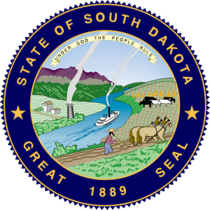
South Dakota Population 2013

south-dakota-population-2013South Dakota Population 2013

The United States Census Bureau estimates that the population of South Dakota in 2013 was 833,354, which is ranked the 46th largest population in the United States. This estimate shows a 2.4% increase since the last census in 2010, also conducted by the United States Census Bureau. The population density of the state is 10.9 people per square mile, ranked 46th largest density in the United States.

South Dakota Population Projections

The population of South Dakota has been increasing at a rate much higher than the rest of the United States. All projections and predictions for the future population of the state are no longer valid due to the unexpected increase in the population.

South Dakota Land Mass

The state of South Dakota is approximately 380 miles long and 210 miles wide with a square area of 77,121 square miles, making it the 17th largest state in the Untied States. Of the 77,121 square miles, only 1,224 square miles are covered by water. The highest point in the state of South Dakota is Harney Peak, which is 7,242 feet above sea level. The lowest point in the state is at Big Stone Lake, which reaches 966 feet above sea level. The geographic center of South Dakota is located in Hughes County, 8 miles northeast of Pierre. South Dakota is bordered by six states: North Dakota, Minnesota, Iowa, Nebraska, Wyoming, and Montana.

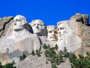
South Dakota can be broken up into four distinct geographic land areas: the Drift Prairie, the Dissected Till Plains, the Great Plains, and the Black Hills. The Drift Prairie covers the majority of the eastern portion of the state. It has many low hills and glacial lakes. The Dissected Till Plains are in the southeastern corner of the state. This area has many rolling hills that intertwine with streams. The Great Plains covers most of the western two-thirds of the state. This area has many hills, canyons, buttes, and plains. It is also home to the Badlands and the Badlands National Park. Lastly, the Black Hills is in the southwestern portion of the state. This area has many mountains and it also has the highest point in the state. The Black Hills is the part of the state full of rich minerals, especially gold. Mt. Rushmore can be found in the Black Hills.

South Dakota Demographics

Of the approximate 0.917 million people in the state of South Dakota, about 49.8% of the population is female, while 50.2% is male. Also, approximately 86% of the population identifies as white (including Hispanic or Latino). But, out of that 86%, only about 3% do identify as Hispanic or Latino and the other 83% as Caucasian. Those that identify as Black or African American make up 2% of the entire population of the state of South Dakota. The American Indian and Alaskan Native populations make up approximately 9% of the entire population of the state. The rest of the population is made up of those that identify as Asian, Native Hawaiian, other Pacific Islanders, or those that identify as two or more races. These other races make up only about 3% of the South Dakota population.

South Dakota Religion

The population of South Dakota identifies as religious at a higher rate than the national average. About 59% of the state population identifies as religious, compared to the national average of 49%. Out of the 59%, about 20% identify as members of the Lutheran Church, making it the largest denomination in South Dakota. The next largest denomination in the state is Catholic at about 18% of the population. All the other Christian denominations make up about 20.8% of the population. Those who identify as Jewish, Islamic, or as an Eastern religion only make up 0.2% of the population.

An American Journey in South Dakota

south-dakota-population-2013-rushmoreSouth Dakota Mount Rushmore

Mount Rushmore, the President’s Mountain, is located in the Black Hills of South Dakota. Mt. Rushmore stands as a shrine of democracy, a monument and memorial to this country’s birth, growth and ideals. Mount Rushmore symbolizes the greatness of this nation through the greatness of its leaders. The epic sculpture of Mount Rushmore depicts the faces of four exalted American presidents that symbolize this nation’s rich history, rugged determination and lasting achievements. The four faces on Mount Rushmore from left to right as you face it are:

  • George Washington
  • Thomas Jefferson
  • Theodore Roosevelt
  • Abraham Lincoln

South Dakota Economy

The unemployment rate in the state of South Dakota is 4%, which is consistently lower than the previous unemployment rates in the state. This is compared to the national average of 7.6% unemployment. The ethanol industry is a very large part of the economy of the state and of the country. It contributed $3.8 billion to the economy in 2012. The most important minerals mined in the state are petroleum granite, and limestone. South Dakota also accounts for 4% of the country’s cattle production.

Other Resources

If you would like to learn more about South Dakota click here.

Kansas Population 2013

Kansas Population 2013

The United States Census Bureau estimates that the population of Kansas in 2013 was 2,888,905, which is ranked the 33rd largest population in the United States. This estimate shows a 1.1% increase since the last census in 2010, also conducted by the United States Census Bureau. The population density of the state is 35.1 people per square mile, ranked 40th largest density in the United States.

Kansas Population Expectancy

Based on a study done by the Center for Economic Development and Business Research, if the migration patterns remain the same in the state, then by the year 2040, the population will grow at an annual rate of 0.48% and reach approximately 3.24 million people in the state of Kansas. However, if there is no migration at all, then the population will increase at an average annual rate of 0.45% and reach approximately 3.22 million people.

Kansas Land Mass

The state of Kansas is approximately 400 miles long and 210 miles wide with a square area of 81,823 square miles, making it the 15th largest state in the Untied States. Of the 81,823 square miles, only 459 square miles are covered by water. The highest point in the state of Kansas is Mount Sunflower, which reaches 4,039 feet above sea level. The lowest point in the state is the Verdigris River, which reaches 679 feet above sea level. The geographic center of Kansas is in Barton County, northeast of the Great Bend. Kansas is bordered by four states in total: Nebraska, Oklahoma, Missouri, and Colorado.

Kansas Demographics

Of the approximate 2.89 million people in the state of Kansas, about 50.3% of the population is female, while 49.7% is male. Also, approximately 87% of the population identifies as white (including Hispanic or Latino). But, out of that 82%, about 11% do identify as Hispanic or Latino and the other 71% as Caucasian. Those that identify as Black or African American make up only 6% of the entire population of the state of Kansas. The rest of the population is made up of those that identify as Asian, American Indian, Alaskan Native, Native Hawaiian, other Pacific Islanders, or those that identify as two or more races. These other races only account for approximately 7% of the entire population of the state of Kansas.

Kansas Religion

The population of Kansas identifies as religious at only a slightly higher percentage than the national average. About 51% of the state population identifies as religious, compared to the national average of 49%. Out of the 51%, about 15% identify as Roman Catholic, making it the largest denomination in the state of Kansas. Those that identify as Baptist make up the next largest denomination with about 10% out of the total 51%. Those that identify as some form of Christian denomination other than Catholic make up 35% out of the 51%. However, those that identify as a participant in a religion other than Christianity (Judaism, Islam, or Eastern religions) make up only about 1% out of the total 51%.

Experience the Natural Kansas

kansas-population-2013-economyKansas Economy

The trade, transportation, and utilities sector of the private sector is the largest employer in the state of Kansas. 23% of those employed in the state work for this sector. The next largest sector is education and health services at 17% of the employed population. However, those who work in the professional and business services and manufacturing sectors come in close to the education and health services sector at 15% and 14% respectively.

Over the last few years, Kansas’ unemployment rate has begun to decrease, along with the national unemployment rate. The Kansas unemployment rate has steadily been less than the national unemployment rate, except for 2004 and 2005 when they were about the same rate. The unemployment rate is projected to continue to decrease over the next year. Over the last year, there has been progress in terms of ratio of job seekers to job openings in the state of Kansas. The rate has improved from 3.2 job seekers for every job opening in Kansas to recently 2.5 job seekers for every opening in Kansas. The most vacant occupation in the state of Kansas is the combined food preparation and serving workers, including fast food. It has the most vacancies over the other occupations by almost double. There are approximately 3,000 job openings for this field, compared to the next highest amount of vacancies, which is for waiters and waitresses, at about 1600 openings.

Alabama Population 2013

alabama-population-2013Alabama Population 2013

The United States Census Bureau estimates that the population of Alabama in 2013 was 4,822,023, which is ranked the 23rd largest population in the United States. This estimate shows a 0.9% increase since the last census in 2010, also conducted by the United States Census Bureau. The population density of the state is 94.7 people per square mile, ranked the 27th largest density in the United States. The population of Alabama is expected to reach approximately 5.2 million people by the year 2025, which is an approximate 7.8% increase from the current population.

Alabama Land Mass

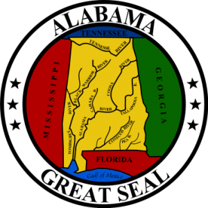
The greatest distance from east to west of the state of Alabama is 210 miles, and the greatest distance from north to south is 329 miles. It has an approximate square area of 52,423 square miles, making it the 30th largest state in the country. Of the 52,423 square miles, 1,673 square miles are covered by water. The highest point in the state of Alabama is Cheaha Mountain, which is 2,407 feet above sea level. The lowest point in the state is at the Gulf of Mexico, which reaches sea level. The geographic center of Alabama is located in Chilton County, 12 miles southwest of Clanton. Alabama is bordered by four states: Tennessee, Florida, Mississippi, and Georgia. The Gulf of Mexico borders the southern portion of the state.

Alabama can be broken up into five distinct geographic land areas: the East Gulf Coastal Plain, the Piedmont Upland, the Alabama Valley and Ridge, the Cumberland Plateau, and the Highland Rim. The East Gulf Coastal Plain makes up the majority of the state with differing types of landscapes. The southwest portion of the state has low and swampy areas. The southeastern portion is an important farming area. The northern portion is often times called the Central Pine Belt due to the many pines trees and hilly regions. The Black Belt Prairie is the portion that divides the Northern and Southern parts of the Gulf Coastal Plain. It used to be home to one of the country’s largest plantations due to the quality of the soil to grow cotton. The Piedmont Upland is in the eastern central section of the state, made up of low hills and sandy valleys. This area is also full of minerals and the highest point in the state. The Alabama Ridge and Valley is to the northwest of the Piedmont and it is made up of sandstone ridges and fertile limestone valleys. This area is rich with coal, iron ore, and limestone, which led to the high production of steel historically in this area. The Cumberland Plateau, located to the northwest of the Alabama Ridge and Valley, is made up of varying landscapes, made up of both rolling and flat terrains. Lastly, the Highland Rim is in the northwestern corner of the state. This area is mainly made up of farmland that grows corn and cotton.

Alabama Demographics

Of the approximate 4.8 million people in the state of Alabama, about 51.5% of the population is female, while 48.5% is male. Also, approximately 70% of the population identifies as white (including Hispanic or Latino). But, out of that 70%, only about 4% do identify as Hispanic or Latino and the other 66% as Caucasian. Those that identify as Black or African American make up only 27% of the entire population of the state of Alabama. The rest of the population is made up of those that identify as Asian, American Indian, Alaskan Native, Hawaiian, other Pacific Islanders, or those that identify as two or more races. These other races make up about 3% of the Alabama population.

Alabama Religion

The population of Alabama identifies as religious at a much higher rate than the national average. About 63% of the state population identifies as religious, compared to the national average of 49%. Out of the 63%, about 37% identify as members of the Baptist Church, making it the largest denomination in the state of Alabama. The next largest denomination is Methodist, which makes up about 9% of the population. All the other Christian denominations make up about 16.6% of the population. Those who identify as Jewish, Islamic, or Eastern religions only make up 0.4% of the population.

Alabama Gulf Coast

alabama-population-2013-sportsAlabama Sports

While the state of Alabama does not have any professional sports teams, there is a large sports fan base in the state. The main attraction is college football. There are two main state universities in Alabama: University of Alabama and the University of Auburn. The common question in the state is whether you are an Alabama fan or an Auburn fan. College football has just as big, if not bigger, of a following than any professional sport could in the state. Whether Alabama fan are yelling “Roll Tide” or the Auburn fans are yelling “War Eagle”, there is a constant battle among friends and strangers between who is the better team. The two teams face off every year in what is called the “Iron Bowl”. Auburn won the first ever Iron Bowl, which took place in February of 1893. However, there was a hiatus from the years 1907 until 1948. Alabama won the Bowl the first year back. The series is currently held at 42-34-1 with Alabama leading the series.

Other Resources

Learn more about Alabama Population Statistics here

Virginia Population 2013

Virginia Population 2013

The United States Census Bureau estimates that the population of Virginia in 2013 was 8,185,867, which is ranked the 12th largest population in the United States. Based on the last census in 2010, this shows a 2.3% increase in the population of the state of Virginia. Based on the population and based on the area of the state, the population density of the state is about 207 people per square mile, ranked the 14th largest density in the United States.

Virginia Population Projections

Based on the historical trends of the state and expected migration, birth, and death rates, the population is expected to reach approximately 8.811 million people by the year 2020, which is an approximate 7.6% increase from the current population. By the year 2030, the population is expected to reach 9.645 million people, which is an approximate 17.8% increase from the current population. By the year 2040, the population is expected to reach 10.53 million people, which is an approximate 28.6% increase from the current population.

Virginia Land Mass

The state of Virginia is about 430 miles long and 200 miles wide with a square area of 42,769 square miles, making it the 35th largest state in the country. Of the 42,769 square miles, 3,171 square miles are covered by water. The highest point in the state of Virginia is Mount Rogers, reaching 5,729 feet above sea level. The lowest point in the state is at the Atlantic Ocean, which reaches sea level. The geographic center of Virginia is located in Buckingham County, 5 miles southwest of Buckingham. Virginia is bordered by five states: Kentucky, West Virginia, Maryland, Tennessee, and North Carolina. The Atlantic Ocean borders the state on the east.

Virginia is broken up into five distinct geographic land areas: the Atlantic Coastal Plain, the Piedmont, the Blue Ridge, the Appalachian Ridge and Valley Region, and the Appalachian Plateau. The Atlantic Coastal Plain lies along the border near the Atlantic Ocean. This area is filled with lowlands, marshes, and swamps. To the west of this region lies the Piedmont, which is the largest land area in the state. This area is mainly made up of rolling plains. To the west of this region lies the Blue Ridge, which is the main mountain range in the Appalachian Mountains. The highest point in the state resides in the Blue Ridge portion of the state. To the west of the Blue Ridge lies the Appalachian Ridge and Valley Region. The Great Valley is part of this area, which is a series of valleys divided by mountains. There are also a lot of caverns in this region. Lastly, the Appalachian Plateau lies along the western edge of the state. This area is filled with rivers, streams, and forests.

Virginia Demographics

Of the approximate 8.186 million people in the state of Virginia, about 50.9% of the population is female, while 49.1% is male. Also, approximately 71% of the population identifies as white (including Hispanic or Latino). But, out of that 71%, about 8% do identify as Hispanic or Latino and the other 63% as Caucasian. Those that identify as Black or African American make up 20% of the entire population of the state of Virginia. The rest of the population is made up of those that identify as Asian, American Indian, Alaskan Native, Hawaiian, other Pacific Islanders, or those that identify as two or more races. These other races make up about 9% of the Virginia population. The Asian population makes up 6% out of that 9%.

Visit Alexandria Virginia

virginia-popultion-2013-religionVirginia Religion

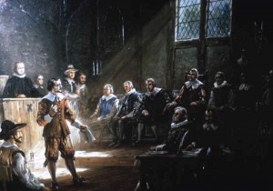
The population of Virginia identifies as religious at a rate slightly lower than the national average. About 45% of the state population identifies as religious, compared to the national average of 49%. Out of the 35%, about 12% identify as members of the Church of Latter Day Saints, otherwise known as Mormonism, making it the largest denomination in the state of Virginia. The next largest denomination in the state is the Catholic Church, making up 9% of the total population. All the other Christian denominations make up about 20.5% of the population. Those who identify as Jewish, Islamic, or Eastern religions only make up 3.5% of the population. About 2.7% of the population identifies as members of Islam, compared to the national average of 0.8%.