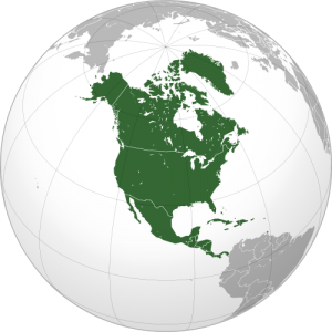
 Population of North America 2014
Based on population expectancies and the estimated population of 2013, the population of North America is projected to reach an estimate of 533,215,000 in the year 2014. As a result, North America remains as the fourth-most populous continent in the world, behind Asia, Africa, and Europe. North America is made up of twenty-three independent states, nine internationally recognized dependent territories, and fourteen other areas, including Greenland, which is a constituent country of Denmark (European nation). The most populous country in North America is the United States of America, which more than doubles the population of the second-most populous country in North America, Mexico. The least populous country in North America is Montserrat, which is a dependent territory of the United Kingdom. The least populous sovereign state in North America is Saint Kitts and Nevvis, which is also the smallest sovereign state in terms of land area and size. The smallest state, including dependent territories, is Saba, a dependent territory of the Netherlands.
Language in North America 2014
There are three major languages spoken throughout North America: English, Spanish, and French. Canada’s official languages are both French and English, making it bilingual. The various provinces throughout Canada have adopted either language as their official language and sometimes both. While there is no official language of the United States of America, English tends to be the most widely spoken language, especially in the workforce and education sector. However, the state of Louisiana deems French as an official language. But, due to the large number of immigrants throughout the country, various languages, including Spanish, French, German, Mandarin, and many others, are also spoken frequently, depending on the location. Latin America, generally indicating the territory south of the United States, most frequently speaks Spanish and Portuguese. The official language of Mexico is considered to be Spanish. Lastly, Belize is not always considered to be a part of Latin America. In fact, the official language of Belize is English.
Geography of North America
There are four major regions of North America: the Great Plains, the mountainous west, the plateaus of the Canadian Shield in the northeast, and the eastern region, which contains various geographic features. The Great Plains extend from the Gulf of Mexico to the Canadian Arctic. The mountainous west includes the Rocky Mountains, the Great Basin, California, and Alaska. Lastly, the eastern region includes things such as the Appalachian Mountains, the Florida peninsula, and even the coastal plains along the Atlantic coast. Mexico is considered to be a part of the western region, despite part of its geographic location in the east.
The boundaries of the continent are sometimes debated, especially in regards to the southern boundary. The West Indies is traditionally always considered to be a part of North America. Also, despite the fact that Greenland is a constituent country of Denmark, its geographic location lies within the boundaries of North America, and so it is traditionally considered as part of North America. The only land connection that North American and South American have is the Isthmus of Panama. Many people declare that this is the boundary between the two continents. However, some people say that the boundary is at the Darien watershed on the border between Colombia and Panama, which would make the entire country of Panama in the North American continent, instead of partially in North America and partially in South America. Lastly, some people say that the most southern point of North America is the Isthmus of Tehuantepec, Mexico.
North American Free Trade Agreement (NAFTA)
On December 17, 1992, Present George H.W. Bush, Canadian Prime Minister Brian Mulroney, and Mexican President Carlos Salinas met in San Antonio, Texas in order to sign the North American Free Trade Agreement. However, the proposed agreement needed to be authorized and approved by each nation’s legislature. Clinton, who won the 1992 Presidential Election, came into office in the midst of the negotiations. But, after adding a couple subsequent agreements, the United States Congress approved the bill. Thus, Clinton signed it into law on December 8, 1993. The main purpose of this agreement between the North American nations was to eliminate most of the barriers to trade and investment. The bill worked to slowly remove the trade barriers over the course of the next ten years between the United States and Mexico. There have been some restrictions on the trade of agricultural goods between the countries, however. The bill also helped create more jobs in the countries, along with allowing some immigrants a legal way to work in the United States. Lastly, the agreement included the North American Agreement on Environmental Cooperation, which established the Commission for Environmental Cooperation to help negate the concerns of the negative impact the agreement would have on the environment.
 Transportation in North America 2014
There currently exists one highway system between the continents: the Pan-American Highway. The Pan-American Highway is made up of 30,000 miles of roads, extending from Alaska down into South America. However, the North American portion of the highway is only 16,000 miles long. Although the roads in Canada are not officially a part of the Pan-American Highway, they still connect and travel throughout the continent. Also, on May 10, 1869, the First Transcontinental Railroad in the United States of America was completed. The final spike was placed at the Promontory Summit, Utah, establishing a transportation system, which helped advance and further the American economy. The economy no longer had to rely on wagon trains for transportation, but could now use the railroad network to travel from the eastern coast of the United States to California.
North American Fox
North American Climate 2014
There are five major climate regions in North America: the Arctic zone, the cool temperate zone, the warm temperate zone, the tropical humid zone, and the dry zone. The Arctic Zone consists of the northern parts of the Canadian Shield and Alaska, the Canadian Arctic Archipelago, and Greenland. The only months that the temperatures may rise above freezing are June to September. Despite only receiving, on average, 2 to 4 inches of precipitation, the Arctic Zone may receive 30 to 60 inches of snow. The cool temperate zone consists of the regions from Newfoundland to Alaska and from the Hudson Bay to the Ohio River. The temperatures in this region range from average lows from -80°F to average highs of more than 50°F. Average precipitation ranges from 15 to 35 inches per year, and the most precipitation occurs during the summer and fall seasons.
The warm temperate zones include the southeast coast of the United States and the American Southwest. The southeast, along with its warm average temperatures, has an average of about 40 to 60 inches of rainfall every year. Hurricanes are a large hazard to these climate regions due to their location near the Gulf of Mexico. The American Southwest experiences averages around 15 to 30 inches of rainfall, but accompanied with high evaporation rates, making it hard to sufficiently grow crops during the summer. The tropical humid climate mainly includes Central America. This climate region experiences average temperatures above 64°F and under 82°F. The average rainfall per year is around 45 to 80 inches. This region also experiences dangerous hurricanes. Lastly, the dry climate region makes up around a third of the continent, including high altitudes in the Arctic regions and certain parts of the American Southwest. This region is plagued by a lack of rainfall, receiving, on average, less than 10 inches per year.
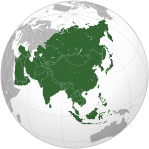 Asian Population 2014
 Southeastern Asia 2014
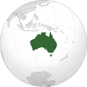 Population of Australia 2014
 Australian Cuisine 2014
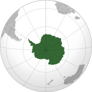 Population of Antarctica 2014
 There are six species of seals on the Antarctic continent: Crabeater, Fur, Leopard, Ross, Southern Elephant, and Weddell. The largest species is the Crabeater, which consists of about 30 million seals on the continent. They are considered to also be the largest consumer of krill, eating around 20 times their body weight every year. They breed during the Austral spring and give birth during the months of December and January. The next largest species is the Fur seal, which consists of about 4 million seals. These seals are the reason that many people began to explore and hunt for seals in the 18th and 19th centuries, due to their valuable fur. The Fur seals breed during the months of November and December and give birth from November to January. Lastly, the next largest species of seals is the Weddell seal, named after the commander of British sealing explorations, Sir James Weddell. There exist about 800,000 seals of this species. They live in the most southern habitation of all the mammals. They live only about 800 miles from the South Pole. These seals breed in December and give birth from September to October.